A watershed is generally defined as an area of land that drains into a body of water, such as a river, lake, estuary, reservoir, sea, or ocean. Thus, all golf courses are in some watershed.
A watershed includes the network of rivers, streams, and lakes that convey the water, as well as the land surfaces from which water runs off. Watershed boundaries follow the highest ridgeline around the stream channels and meet at the bottom or lowest point of the land where water flows out of the watershed. The boundary between watersheds is defined as the topographic dividing line from which water flows in two different directions.
Identifying and defining watersheds depends on the scale at which the landscape is examined. A watershed may be small and represent a single tributary within a larger system (such as a subwatershed), or be large and cover thousands of miles and cross numerous state boundaries, such as the Chesapeake Bay watershed. New York State is divided into 17 watersheds.
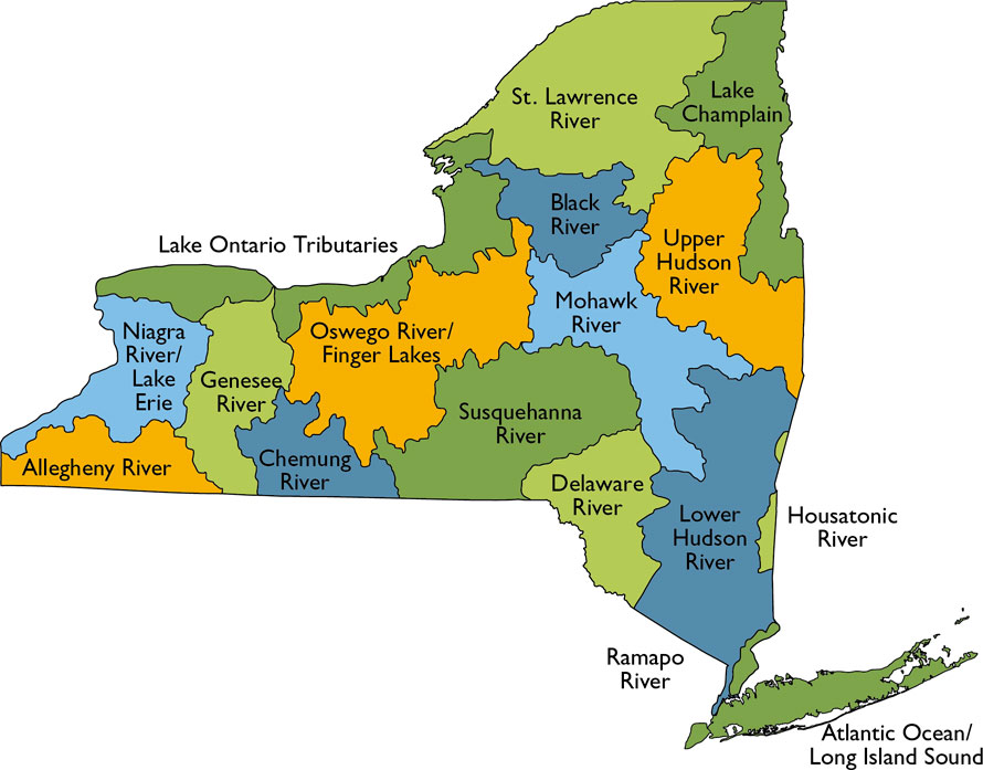 Watersheds in New York State.
At a larger scale, the U.S. Geological Survey (USGS) has divided and subdivided the United States into units classified into four levels: regions, subregions, accounting units, and cataloging units. A fifth field of classification (watershed) and sixth field (sub-watershed) are currently under development by USGS. The hydrologic units are arranged or nested within each other, from the smallest (cataloging units) to the largest (regions). Note that watersheds cut across typical regulatory boundaries such as counties and states, which can complicate regulation.
The first level of classification divides the United States into 21 major regions. Regions contain either the drainage area of a major river, such as the Missouri region, or the combined drainage areas of a series of rivers, such as the Texas-Gulf region, which includes a number of rivers draining into the Gulf of Mexico. New York State is situated within the boundaries of three regions: Ohio, Mid-Atlantic, and Great Lakes.
USGS Hydrologic Units Example
Cataloging Unit: French RiverAccounting Unit: Allegheny
Subregion: Allegheny River Basin
Region: Ohio
- NYS Department of Environmental Conservation (NYSDEC) web site on New York watersheds (http://www.dec.ny.gov/lands/26561.html)
- USGS watershed classification (http://water.usgs.gov/GIS/huc.html)
- U.S. Environmental Protection Agency (EPA) Surf Your Watershed (http://cfpub.epa.gov/surf/locate/index.cfm)